
Vermont’s Spookiest Stretches of Woods After Dark
The gates on Route 108 were still open last week, so I drove up into Smugglers’ Notch from the Jeffersonville side a little after five. By the time the road pinched down to one lane between the boulders, the daylight was gone and my headlights were the only thing moving. Fog had settled into the hairpins, and the cliffs on either side simply disappeared above the beams.
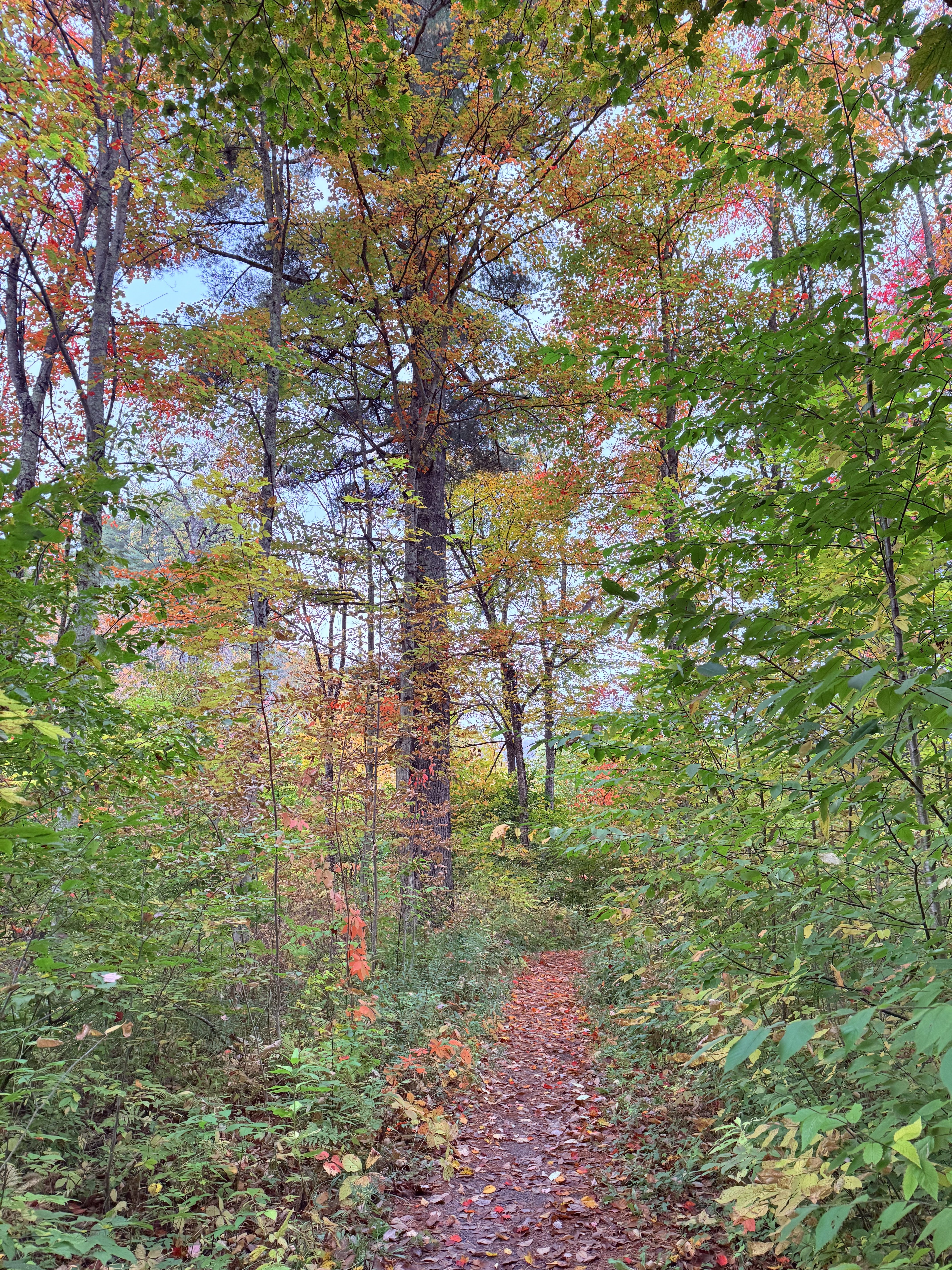
That’s the kind of evening that reminds you why late October belongs to the spookiest woods in Vermont. Nothing jumps out at you. The leaves are just down, the dark arrives before dinner, and the forest starts to sound different. Every snapped branch carries, and every stone wall running off into the trees seems headed somewhere you can’t quite see.
These are the stretches of woods that people around here go a little quiet about once the sun sets, plus some honest notes on visiting them safely as the season turns.
Where are the spookiest woods in Vermont?
Most of Vermont is forest today, but walk almost any patch of it and you’ll find proof that it wasn’t always. Stone walls cut straight through stands of sugar maple. Cellar holes sit in the ferns with a lilac or an old apple tree still growing beside them. Generations of hill farmers cleared this land and then left it, and the woods quietly took everything back.
That’s where most of the spookiness comes from. It isn’t ghosts so much as absence. The places that get under your skin after dark tend to fall into a few categories:
- Abandoned settlements, where foundations, cemeteries, and old roads are all that’s left
- Unsolved mysteries, where real people walked into the woods and never walked out
- Genuinely dark country, where there’s no glow on the horizon and the nearest porch light is miles away
If you’ve already read through our roundup of Vermont’s haunting urban legends, a few of these will sound familiar. This time the focus is on the woods themselves.
What is Smugglers’ Notch like at night?
Route 108 between Stowe and Cambridge is a beautiful drive in daylight. After dark, it’s something else entirely. The road climbs through a narrow pass between Mount Mansfield and Spruce Peak, squeezing around boulders the size of small houses, with cliffs rising on both sides. Cold air pools at the top, and on a still night you can hear water moving somewhere in the rocks long before you see it.
The Notch earned its name honestly. As the story goes, Vermonters moved goods through here to Canada when the Embargo Act of 1807 cut off trade, and the caves and hollows in the rocks fed rumors of hidden stashes for generations after. Our post on the hidden history of Smugglers’ Notch covers the smugglers and later bootleggers in detail.
Timing a Notch drive this time of year
The road through the Notch closes for the winter once snow and ice start to stick, usually sometime in mid to late November, and it can close temporarily before that whenever the hairpins turn slick. When the gates are open, take it slow, use your low beams in fog, and only stop in the established pull-offs. The tightest turns have no shoulder at all, and cell service at the top is spotty at best.

Is Ricker Basin in Little River State Park a real ghost town?
In a sense, yes. In the hills above Little River State Park in Waterbury, roughly 50 families once farmed a high, stony basin on the slopes of Ricker Mountain. They cleared fields, built sawmills and a schoolhouse, and hauled everything up and down roads that feel impossibly steep even on foot.
The land never made it easy. Thin soil and hard winters pushed the younger generations out first. Then the November 1927 flood tore through the valley and drove families onto their roofs, and a second flood in 1934 finished off what was left of the community. The Civilian Conservation Corps built the Waterbury Dam in the years that followed, and part of the old settlement now sits beneath the reservoir.
What remains is scattered through the woods: cellar holes, stone walls, sawmill ruins, old town roads that have faded into trails, and Ricker Cemetery on the hillside. One farmhouse, the Almeron Goodell place, still stands, weathered and leaning a little more every year. People have traded rumors for years that the basin is haunted, though nobody ever seems to have a specific story to back it up. Walk it at dusk in late October and you’ll understand why the rumors stick anyway.
Walking the History Hike
The park’s self-guided History Hike follows the old roads up through the settlement. Within about half a mile you reach the big cellar holes of Gideon Ricker’s farmhouse and barn, and continuing a short way to Ricker Cemetery makes for an out-and-back of roughly a mile and a half. The full trail network runs much longer if you want to keep going toward the Goodell farmhouse.
You’ll notice that hikers have set old bottles, tools, and bits of rusted farm hardware along the tops of the stone foundations. It’s a long-standing habit, and the right move is to look and leave everything exactly where you found it. The campground closes for the season in late October, so check with the park before heading up after that, and plan to be back at your car before full dark.
Is Emily’s Bridge in Stowe actually haunted?
Ask anyone in Lamoille County for a ghost story and Emily’s Bridge will come up within a minute. The Gold Brook covered bridge in Stowe Hollow dates to 1844, and the legend of the young woman who supposedly haunts it has a dozen versions, none of them verifiable and all of them told with complete confidence. Visitors report scratches on their cars, sudden cold spots, and voices over the brook.
The bridge sits in a quiet residential neighborhood, but it’s the wooded ravine of Gold Brook around it that really sets the mood after sunset. We’ve covered the legend and its many variations in our post on Emily’s Bridge and its ghostly tale. If you go, keep it respectful. People live right there, and they’ve heard every version of the story already.

What is the Bennington Triangle, and can you hike there?
Down in the southwest corner of the state, the Long Trail climbs north from Route 9 in Woodford toward Glastenbury Mountain through some of the emptiest forest in Vermont. Between 1945 and 1950, five people disappeared in the woods around that mountain, and only one body was ever found. Vermont folklorist Joseph Citro later popularized the name that stuck: the Bennington Triangle.
The first was Middie Rivers, an experienced hunting guide in his seventies who got ahead of his party near the mountain in November 1945 and was never seen again. The most famous was Paula Jean Welden, an 18-year-old Bennington College sophomore who set out on the Long Trail from Woodford Hollow on the afternoon of December 1, 1946. She asked a group of hikers a few questions about the trail, kept walking north, and vanished. Hundreds of searchers combed the mountain without finding a trace.
The Glastenbury Wilderness today is protected backcountry, and the hike to the summit fire tower is a serious day, roughly 20 miles round trip with more than 3,000 feet of climbing. That’s the real lesson of the Triangle for anyone visiting in late fall. The trails up there are long, the weather turns fast, and the daylight runs out sooner than you think. The full story of the disappearances deserves its own post, and it’s coming soon.
Why are the woods around Victory, Vermont so dark?
Head up into the Northeast Kingdom, past St. Johnsbury and into Essex County, and the gravel roads start to feel like they’re leading you away from the rest of the century. Victory and neighboring Granby were the last two towns in Vermont to be connected to the electric grid, and the lights didn’t come on there until 1963.
Even now, the Victory Basin is about as dark as Vermont gets. Victory State Forest and the Victory Basin Wildlife Management Area wrap around one of the largest boreal bogs in the state, a wide, wet bowl of spruce and tamarack along the Moose River where the snow comes early and moose are a far more common sight than neighbors. In the 1960s there were serious plans to dam the river and flood the bog, and a long fight by conservation-minded Vermonters is the reason it’s still there.
Nothing in the Victory woods is haunted, as far as anyone will admit. It’s just the kind of dark that makes your eyes play tricks. A pair of glowing eyes at the edge of the road turns out to be a moose standing perfectly still, and the silence is so complete that your own footsteps start to sound like company. If you’re planning a trip up that way, our Northeast Kingdom weekend guide is a good place to start, and clear nights in the basin make for remarkable stargazing.
Is it safe to walk in the Vermont woods after dark in November?
It can be, but late fall in Vermont comes with a few realities that summer visitors don’t usually think about. The biggest one is hunting season. The woods are shared from now until well into December, and hunters are most active at exactly the hours that feel the most atmospheric, dawn and dusk.
For 2026, archery deer season runs October 1 through December 15, and the regular rifle season runs November 14 through November 29. Hunting is allowed on Sundays here, too, so there’s no day of the week when you can assume the woods are empty. Locals wear blaze orange on every walk this time of year, and they put it on the dog as well.
The other reality is the light. Clocks fall back on November 1, and by the middle of the month the sun sets before 4:30 in northern Vermont. A walk that starts at 3:30 can easily end by headlamp. If you love being out there anyway, our post on why hiking in stick season is a must-do has more on making the most of the short days.
A local’s short list for exploring after dark
- Carry a headlamp and a spare, even on a short walk, because a phone flashlight dies fast in the cold
- Tell someone where you’re going and when you’ll be back, especially in the Notch, Glastenbury, or the Kingdom, where cell service drops out
- Wear blaze orange from now through mid-December, and put a vest on your dog
- Stick to state land, marked trails, and legal pull-offs, and respect posted land
- Leave cellar hole artifacts, gravestones, and old foundations exactly as you found them
- Dress for the temperature at the top, not the bottom, because cold air settles hard in the hollows after sunset
Most nights, the scariest thing you’ll meet in these woods is the sound of your own heartbeat when a deer crashes off the trail. That’s half the fun. The other half is standing in the dark beside a stone wall someone built two hundred years ago and realizing the forest has been keeping its own company for a very long time.
The Vermont woods never really empty out after dark, they just stop pretending you’re the one in charge.
Shop Green Mountain Peaks on Etsy
Bring a little piece of Vermont into your home with our curated collection of gifts, apparel, and seasonal favorites. From cozy hoodies and crewnecks to Vermont-themed gift boxes and cookbooks, each item is designed to celebrate the Green Mountain spirit.
- Vermont-inspired designs and gift sets
- Printed and packaged with care
- Ships directly to your door
Discover gifts, apparel, and Vermont treasures made to share and enjoy year-round.
Leave a Reply